Showing posts with label buckden. Show all posts

Wednesday, 23 July 2014

Sat July 5th - Le Tyke Sportif or Litton to Buckden (and back) for the TdF

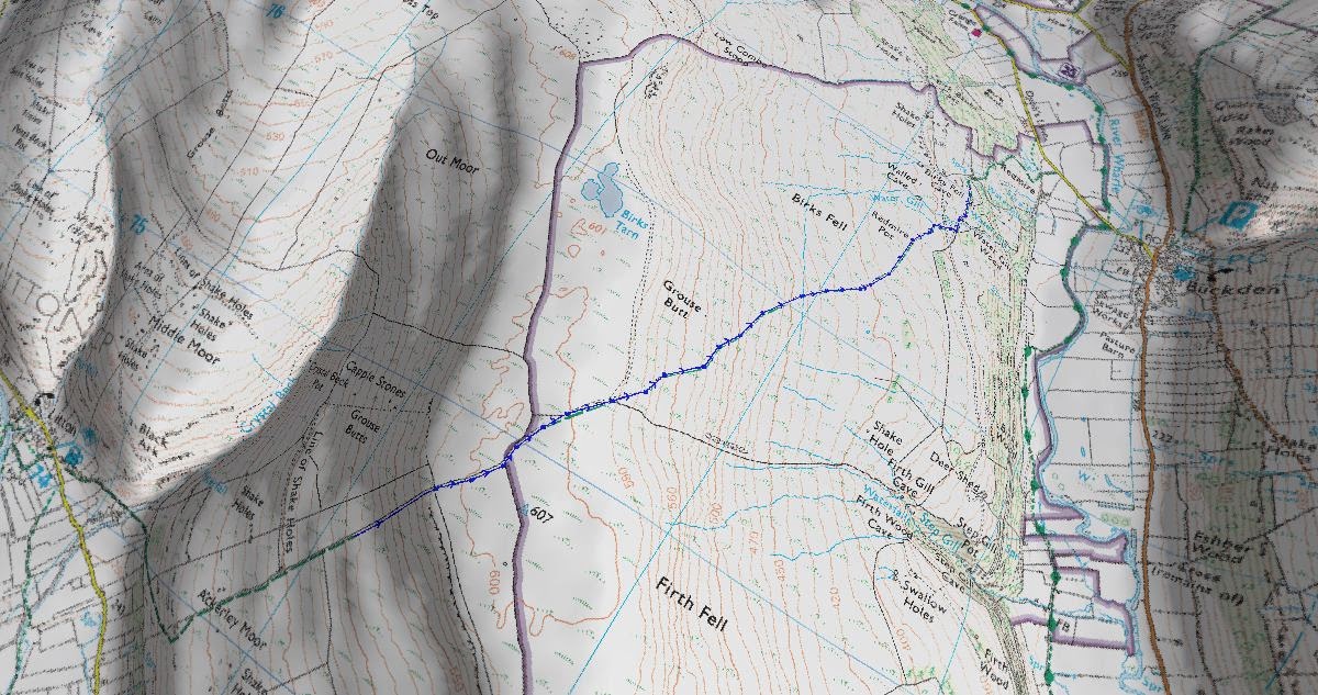
The walk today was a bit of a last minute plan. On Wednesday the 2nd, the one just gone and three days before the walk was due, we decided to go and watch the Tour de France through the Dales. Such a simple thought. With hindsight, it was certainly easier to type that than it was to research the route and and work out an itinerary. The initial idea was to watch the hill climb stage, the first of three that day at the "'Cote de Cray". We had been around here in January when we did Buckden Pike (see previous blog) and the route was quite accessible. However, the fly in the ointment was that the roads leading to Buckden and beyond were closed to vehicular traffic from 6am on the morning of the Tour de France (TdF) which made access a little difficult unless we were willing to set off before 4am. With that road closure in mind and looking at several other options we found we could quite easily access neighbouring Littondale, the valley running parallel, park there at The Queens Arms and then 'nip' over the hill of Ackerley Moor & Firth Fell to drop down the bridlepath into Buckden. Simple, as meerkats seem fond of telling us.

Distance: 7.54 miles
Ascent: 2458 ft
Sandwiches: Ham with Piccalilli, Cheese & Garlic sausage salad, pork pies
Soup: Too warm for soup, so took a bottle of French Red and Rose to see if they went well with pork pie.


Elevation Profile
Route Map


3D View of route

We drove to Settle and then took the B6479 road up to Stainforth. We passed through this little village to pick up the moor road to Halton Gill at the head of Littondale. The drive to Littondale from Settle is absolutely glorious, and must be one of the best driving routes in the country. It is a quiet, but very scenic, back road that runs between Pen Y Ghent and Fountains Fell and offers great panoramas of the surrounding grand landscape.

As we dropped down into Halton Gill we came across many cars parked on the open grass verges adjacent the road. Every car had a bike rack on the roof or the rear tailgate. This was a sign of the things to come. We turned right just after crossing the bridge in Halton Gill and continued along the single track macadam road that runs along the valley bottom until we got to the small hamlet of Litton and the Queen Arms. There was much traffic parked along the road and the pub had anticipated this and was running a car park in the field opposite. They were charging £10 for the day. The price really took me by surprise because when he lady minding the car park announced the cost I came out with that well known Yorkshire phrase " 'Ow Much?!?!". They might not like spending it, but by God, they like charging it.

Anyway I paid Dick Turpin and we parked up, changed our footwear, and I heaved the big rucksack out of the of the car, strapped it to my back and we proceeded to walk to Buckden. We got to the front of the pub and turned right to head along a bridlepath that ran through some stone farm buildings. To my dismay the path immediately started upwards. We continued along the path, which was more of a lane than a track and dropped down to a ford and crossed Crystal  Beck which appeared very dry for this time of year. We were then back to an uphill section, and from here it was uphill all the way! From Crystal Beck to just below Ackersley Moor the path was a steady incline running upwards along the contour lines on the hillside and made for steady going. After crossing through a stone wall, there was an abrupt left turn and the path went straight up the hillside - no gradual incline using the contours here, just straight up. The climb up was incessant and we did have to keep pausing to get our breath, and admire the view which was extensive due to the great weather.
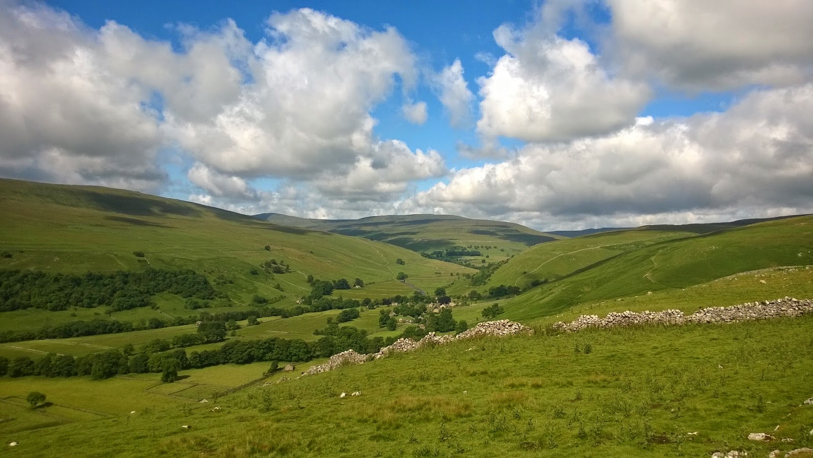

Looking up Littondale
We could clearly see the path stretching out in front of us directly up the hillside. There were some people ahead of us who were making good progress, and one guy and his dog actually ran past us which made us feel very unfit. We continued climbing and the path did get steeper at one point. We passed a middle aged guy wearing a wide brimmed hat who appeared to be having difficulty getting his 8 or 9 year old daughter up this hill. You could see that she just didn't want to do it and he was having to coax her all the way. I know just how she felt.


Looking down Littondale
After much huffing and puffing, groaning and moaning we found the ground to start levelling out and before we really knew it, we were on a flat summit plateau and making easy progress along a stone flagged path. Oh the joy! A sense of relief came over me at the realisation of not having to climb up any further, and that from here on to Buckden it was all downhill. We passed the summit trig' point which was some distance away on our right and were soon making a descent down into Buckden itself.

As we started to descend the view beyond Buckden Pike was very extensive, and we could clearly see the B6160, the road that formed the "Cote De Cray", and even from this distance it was obvious that it was already packed with people. At this point we decided to change our plan and just stay in Buckden and leave the Cote de Cray until another time. Too many people there and the additional distance with this weight on my back would be purgatory. The heavy rucksack was sapping my energy already, so the chance to knock a mile or so off the distance was welcome and seized upon. We made some great progress down the bridle path into Buckden and got a real move on. I had forgotten the estimated times for the peloton to pass through and thought it was about half past midday, so we were eager to find our spot and sit and enjoy the carnival-like atmosphere.

We approached the village green in Buckden and found it to be quite busy. We walked up towards the church and found a spot on the grass verge beside the road. There were a number of people lining the roads, although not as many as on the hill climb stage.


Looking back to Buckden

Leaving Buckden towards Cray

It was a huge relief to take the rucksack off. I felt as  though I was floating for several minutes afterwards. We unfastened our folding chairs from the rucksack, set them out and removed a bottle of wine from the bag and proceeded to have drink and some nibbles, and soak up the carnival atmosphere.

We watched the Gendarmerie come through, our own Bobbies on their motorbikes, various sponsors and team vehicles passed and all of them were waving to the crowds, tooting their horns and enjoying the atmosphere of the TdF.


Bonjour, bonjour, bonjour... ce qui est tout ce alors?
Lead car for the race

The front breakaway group

You could tell the riders were getting close as the sound of the many helicopters in the air was menacing. It brought to mind a scene from Apocalypse Now. The three riders from the breakaway group came through first, and the crowd could be heard cheering as they approached and was like a audible Mexican wave rippling along the crowd keeping pace with the riders.


A team car

Timing officials

Helicopter filming the peloton

The peloton
After a couple of minutes the main peloton flew past, and I do mean flew! There were gone in about 30 seconds and then after the team cars passed by the route was silent. It was a very colourful spectacle, and the chances of seeing it again in Yorkshire are probably very limited too.


Team Lotto-Belisol (Belgium)

Team Tinkoff-Saxo (Russia)

Team Sky (Great Britain)

Team Sky (Great Britain) and Team Movistar (Spain)

Team Movistar (Spain)

Gendarmerie and team cars

Team cars heading up to Cote de Cray

We decided to move from the roadside and walked back down towards the village green in Buckden. We found a suitable spot, unfolded our chairs and continued with our picnic. It was at this point we started to see cyclists coasting back down from the Cote de Cray. Some of them took to stopping on the village green, and others just continued on their way heading down towards Starbotton and Kettlewell. We sat on the green for well over an hour and watched a continuous stream of cyclists flowing along the road whilst eating ice cream. I have never seen so many push bikes! We got talking to a chap who had come up a couple of days before with Gloucester City Cycling Club and was cycling back to Skipton prior to the journey home. We presumed that many others present had also travelled some distance too - there couldn't be so many cyclists in Yorkshire, although this point seemed to evade the national press who produced a number of belittling articles about the whole thing thinking it was only Yorkshire folk who turned out to watch, and the hidden message of course was who would want to go to Yorkshire to watch a bike race. I expect their reporting would have been different if the Grand Depart had been within the M25, and then if that had been the case we wouldn't have heard the last of it on the BBC news or national press either.

We finished off our picnic and drained the second of the two bottles of French wine we had carried over and decided to make our way back. We folded the two chairs and strapped them to the rucksack, I heaved it onto my back and we made the return journey. 

The climb started as soon as we got off the macadam road leading to Hubberholme. As I trudged up the winding gravel track a number of people passed us who were not carrying the same weight, or were barely into their teens. We plodded on, steadily climbing upwards until we got to the area of Redmire Pot where the picnic blanket came out, the rucksack came off again and we had a lie down for an hour in the diminishing sunshine. Looking for the picnic blanket gave me a chance to see if Mrs MuddyBoots had secretly stowed some rocks in the rucksack as it seemed the weight hadn't diminished at all; after a brief search there were none to be seen, but I did come across a bag of chewy Haribo sweets. I lay on the blanket in the sunshine with the breeze blowing over me chomping on the sweets and I very nearly dozed off!

After an hour we packed the blanket up, hoisted the rucksack again and plodded on, ever upwards. The path was never ending, at one point I began doubting if this was the same path we took on the way down as it seemed to take forever to progress along it.


View down to Buckden with Buckden Beck running down from Buckden Pike

There were timber post waymarkers on the path up the hillside and I was using these to keep moving me along - "keep going until the next post.. go on; you can do it" was a phrase repeated continually in my head until I neared the summit. When we reached the stone flags placed by conservation volunteers we knew we were almost at the top. The hill summit plateau was a relief, as by this point my legs were feeling the strain and I suspect the wine consumed during the picnic hadn't helped much either. I was getting very close to dumping the bag and coming back for it at a later date.
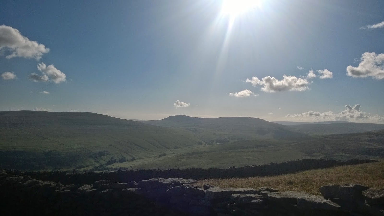

Looking down Littondale with Pen-Y-Ghent on horizon
As we progressed along the summit plateau the view back down Littondale was fabulous, and the distinctive silhouette of Pen-Y-Ghent stood out on the horizon. I took several minutes to just stand there and take in that view. It made the effort to get there worthwhile. The path was now downhill all the way to the car and this became quite difficult. The hillside was quite steep, my legs were tired and I was very conscious of losing my footing and going for a tumble. My walking pole would have come in very handy at this point, and for some unknown reason I had decided to leave it in the boot of the car. Perhaps the additional weight bothered me!


The view away from the head of Littondale, with Pendle Hill visible in the distance

We slowly and carefully descended back down into Littondale, and the views made up for the discomfort. The sun had started to go lower in the sky and the shadows were now getting longer. In time we got back to the car and with a satisfied groan I took the pack off for the last time and dumped it onto the grass behind the car. Mrs Muddyboots tried to pick it up to place it in the boot and couldn't. She was then quite incredulous that I had carried it that distance and over "that hill". A quick replacement of footwear made for a refreshing change and we hobbled off to the pub to rebalance our fluids.

We sat outside the Queens Arms and slowly sank a pint of very cold lager. By now the sun had gone behind Plover Hill and it was getting quite cool in the shade. We discussed tea, and then decided against eating here this time. We drained our glasses and went back to the car for the journey back home.


Pen-Y-Ghent from Dale Head farm entrance
The journey home was steady and uneventful, and we were not in any particular rush to get back either. When we got home we watched some of the TdF television footage recorded from earlier in the day and it really was a showcase for the Yorkshire Dales. The live transmission was done by a French TV company and as such many of the place names had been renamed, particularly Skipton Castle, or "Chateau du Skipton" as the French have it. The aerial footage was a Yorkshire Tourist Board PR mans wet dream - scenery and views that you just couldn't buy. It showed the Dales off in all their glory and they looked superb indeed and made us realise just why we enjoy going over there walking... praise indeed from a staunch Lancastrian.

Vive Le Tyke Sportif!

Saturday, 15 February 2014

2nd Feb 2014 - Buckden, Buckden Pike, Cray & Hubberholme

After last weekends disappointing weather and lack of exercise, we decided that we would go out this weekend no matter what. The weather the previous weekend was just continuous s rain and after looking g online at several webcams I came to the conclusion that it was just as easy to stay local and get wet as it was to drive and hour and a quarter and get wet. The end result after studying the weather and webcams was that it was difficult to escape the warmth of the log fire and drag ourselves into the rain and wind. All was not wasted though as I did manage to get the maps out and work out several walks in advance so I would always have a few 'in hand', and not have the problem of the previous week of staying local due to not sorting the next walk out during the week.

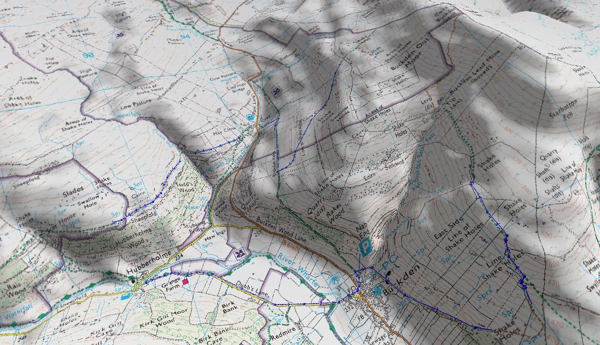
The walk was going to be in Wharfedale, and to start at Buckden, progress up Buckden Pike and then drop down to Cray. After Cray it was a steady stroll to Hubberholme and then back to the start.

Distance - 8.3 mi
Ascent - 1908 ft
Sandwiches - Roast beef & horseradish on home made wholemeal bread
Soup - Homemade chicken and vegetable

Elevation Profile

Route Map

3D Route Map

We parked at the "Dick Turpin" National Park car park, where we were relieved of £4 for the privilege of parking. As usual, when we got there the car park was very busy. We pulled our boots out of the rear of the car and changed into them. Hats, fleeces and jackets came on too. Finally, the rucksack was hoisted up onto my shoulders and we were away.

We went across the car park heading away from Buckden and after passing through a gate turned right ninety degrees and started going up hill. What did I say about trying to avoid this sort of thing after stepping from the car? The uphill wasn't any distance really, and it got us to the edge of Buckden Beck to a ford and stepping stones across the Beck. The stepping stones were barely visible under the torrent of white foaming water that was rushing down the beck. It would be a bit foolhardy to try and cross here, the water would easily have gone over the boots and the force of the stream would have swept your feet away. What to do? No more than 500 yds into the walk and we had halted. We decided to walk upstream to see if it was possible to cross further up. After five minutes of walking uphill along the banks, we came across a large rock sticking up, and out of the rushing water. It looked ideal to stand on and launch oneself across the beck. I tossed the rucksack over, so we had no option now but to cross here - the car keys were in the bag! It was quite a leisurely leap across and actually far easier then the stepping stones lower down. We tracked around the base of the hill and got back onto the permissive path that climbed up above Eshber Wood. The path was actually an old cart track and clearly used by agricultural quad vehicles. It was good going at the start of this track although as we gained altitude the track went steeper and our breathing became more laboured.

Looking down to Buckden
We continued upwards braving the hailstorms and with the wind really cutting through you. The views up, down and across Wharfedale were terrific which was some compensation as there seemed to be no respite with this climb; it was just a constant slog upwards. We stopped several times to catch our breath as we pressed on, on and on. We started to see snow on the north facing sides of drystone walls. When the path gradually eased we decided that this would be a suitable time to have bite to eat.

Looking North up Langstrothdale
Lunch spot; a sheepfold above East Side
Feeling fortified by the sandwiches and hot, steaming chicken and vegetable soup we started back on the path. Whilst the gradient had eased and the walk was quite easy, the going underfoot was very muddy and slippery. We did notice that as we had now reached more snow, we were following in the tracks of two people, one with a walking pole and they accompanied by a dog. We had seen nobody so far on this walk. We remained on the muddy, wet track heading for Buckden Lead Mine and it was quite clear that the mine was close as the spoil heaps from the mining activity really stood out on in the landscape.

Spoil heaps from Buckden Lead Mine
Mine entrance and disused buildings
Entrance to Buckden Lead Mine
I didn't know a mine existed here, although I am aware of lead mining above Swaledale. It must have been a hard existence to come up here in all weathers and start a day of physical toil hacking away at hard rock by the light of a candle. I was intrigued to find out more, and there is quite a lot of information about the mine, it's history and the body which was found in there in 1964 by some students.

We passed over Buckden Beck (again) which appeared to run from the disused mine entrance and tumble very quickly down the steep ravine that leads to Buckden village. The climb away from the mine was very steep indeed and it felt like a punishment to start off again up such an incline. The climb again was relentless and the amount of snow surrounding us was also increasing with the height we gained. We saw the steep hill stretching out infront of us and it felt a bit dispiriting to look at. We just put our heads down and watched our footing as we slowly made progress up through the snow. After what seemed an age and with heart thumping and legs weary, the ground levelled out and we realised we were now at the summit. We looked to our left and the summit trig point was visible over a stone wall surrounded by ice and snow. Their was a stile to climb over and a small walk remaining to get to the 'official' top.

Buckden Pike, summit trig point
Summit cairn viewed from trig point
Their were paths made from old mill floor flagstones across the summit of Buckden Pike and these lead past the trig point and out to the stone cairn also on the summit. We made a point of going to the cairn and placing a small stone on the top of it before taking the path to descend down to Cray. The wind on the summit would be what you could call a 'thin wind' - so thin, it seems to go through you.

The path from the summit down towards Cray made for very good progress, it had been remade from gravel and had pitched stone steps. Our rapid progress downwards was occasionally interrupted by knee deep snow. We were now on the lee side of the hill and thus snow had settled into the sheltered parts of the hillside which we seemed to find quite easily on and off the path. Quick progress was made and we soon arrived at Buckden Rake which was a refreshing change in that it was very level and the going underfoot was quite good. Rapid progress was made until we arrived above Cray and then more downhill progress was required. We arrived at the ford over Cray Gill and the stepping stones across the Gill were easily seen. Our very muddy boots were rinsed in the Gill, a deep breath taken and we started gingerly over the stones.

Fellow walkers following us over to Cray

The White Lion Inn at Cray
After safely negotiating the stepping stones over the Gill, we thought it best to nip into the White Lion Inn for something to settle the nerves after the stepping stones. I opted for a pint of Copper Dragon Golden Pippin, a light refreshing blonde ale with a citrus hint. It was excellent. My better half went for a lager, however the cask lager was off. This was due to a coach party who were touring the pubs in the Dales coming in the previous day and emptying a full, new keg - all 88 pints! So bottled it was. We sat by the fire taking in the warmth from the logs and savouring the beer - I really could have sat there all day.

The fire in the White Lion Inn
Before long we had emptied our glasses and we decided to start making a move downhill towards Hubberholme. We dragged ourselves outside and decided to walk along the road to Hubberholme instead of the planned route above Todds Wood. Dusk was approaching and walking in the dark along a muddy path had lost its appeal. We started to walk down the road, after a short while we took a right turn down a narrow, but steep tarmac road. This took us over Stubbing Bridge and into Hubberholme passing via the beautiful 12th Century church of St Michael and All Angels.

St Michael and All Angels Church, Hubberholme
The George Inn viewed across the river Wharfe
As we approached The George Inn we came across a sign that indicated that the pub was open from 12:00 - 3:00 for sandwiches etc and then from 6:00pm - 10:00pm for meals. We actually misunderstood this sign and thought that outside of those times the pub was actually closed.  We felt disappointed, but did try the door and surprisingly it was open. We went in. The landlord, Ed, was sat infront of the fire and we asked of he was open. He replied in the affirmative and our spirits picked up considerably. We didn't realise it was food serving times only on the board outside - doh! I ordered a pint of Yorkshire Dales "Le Tour de Yorkshire Dales" - a pale, citrus, refreshing bitter. This was followed up with a pint of Black Sheep which is a perennial favourite. My better half had lager - just standard, everyday Carlsberg/Stella/Carling/Fosters or whatever. The name changes but the taste is just the same.

We took a seat opposite the fire and ended up chatting to Ed and he gave us a brief history of the pub and also noted that he and his wife are new to the place and have been running it for about 9 months now. The famous candle was burning on the bar and the fire was well stoked too.

The lit candle on the bar of The George Inn
An inviting coal fire
As we were chatting some locals came in and joined in the conversation, and shortly after this the landlord and landlady of The White Lion in Cray came in too. We stayed and had the pub chilli with chips and rice, and very good it was too. Hot enough to be a 'real' chilli, but not 'blow your socks off' hot that makes your eyes water. It was great, full of flavour and much needed after a day in the hills. After we had finished eating we were introduced to George, the 'new' pub dog. George was an 8 week old Jack Russell who was too cute for his own good!

George, the pub dog, at 8 weeks old
The George Inn as we departed into the darkness
We lost track of time and before we knew it we had been sat in there for 3 hours drinking, talking and eating. We still had a mile to walk back to the car. We settled our bill and then made our goodbyes and went outside, not realising just how dark it was with the complete absence of any street lights. We started to make our way along the road heading back to Buckden and at first this was fine, but as the light from the pubs outdoor illumination faded we were walking in complete darkness. At one point we were feeling our way along the drystone walls in order to keep on the road. After ten minutes our eyes had started to adjust and we could make out larger features of the landscape, and using our peripheral vision, the dark track that was the road could be seen. As we continued along the road we dodged several large puddles where the road had flooded, and we were keeping a keen eye out for any vehicles because, as usual, we had dressed for the event by wearing black and there were no footpaths on this road. After around 20 minutes we had made our way back to the car park in Buckden without any incident.

As we got to the car, we opened it up, started the engine and turned the heater to full whilst we changed our footwear at the rear. It was great to get the rucksack, hat and gloves off and have a change of boots. After packing the gear into the car, and settling into the driving seat, we set off back home mulling over the day and agreeing to visit the George Inn again at some point in the near future.